|
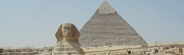
FIG Working Week 2005 and GSDI-8 in Cairo, Egypt
April 16-21, 2005
From Pharaohs to Geoinformatics - Shaping the Change
The FIG Working Week 2005 was organised in Cairo, Egypt 16-21
April 2005. This was for the first time that the annual FIG Working Week was
organised together with another international organisation. The FIG Council
and the local organisers - the Egyptian Committee for Surveying and Mapping
(ECSM) and the Egyptian Survey Authority (ESA) - decided to organise the
conference jointly with the Global Spatial Data Infrastructure (GSDI). So
the joint conference "From Pharaohs to Geoinformatics" combined
elements both from the FIG Working Week and the GSDI conference (this time
GSDI-8). The reactions from the participants and conference statistics show
that the concept was a success story in many ways. Whether FIG will organise
joint conferences in the future will be decided after the Council has
carefully evaluated the results from Cairo.
The joint FIG/GSDI conference turned to be the biggest ever
FIG annual conference outside congresses, which are held every four years.
The conference attracted more than 900 participants from more than 80
countries. The attendees got an excellent opportunity to get familiar with
the history of surveying and even more important on the trends in
surveying and SDIs for the future.
The technical programme was almost overloaded - during the
three and half day technical programme there were 51 technical sessions,
several round table discussions (e.g. on the education in Africa, FIG future
governance, standards etc.) and working group meetings. When totally seven
pre-conference workshops (each lasting for a half or for a full day) are
added there was professional programme for almost one week. In the technical
programme more than 400 papers, presentations and posters were made.
Unfortunately there were some last minute drop outs in the technical
sessions due to different reasons (e.g. travel and visa problems). For the
future events the FIG Council and commissions will consider all reasons and
decide how to improve the situation at the next events. This evaluation will
also include the role and format of the poster presentations.
At the opening ceremony the keynote address from the
Government of Egypt was made by HE Dr. Mahmoud Abu Zeid, Minister of
Water Resources and Irrigation. The conference was held under the patronise
of the Government of Egypt and Prime Minister, Dr. Ahmed Nazif, who
unfortunately was unable to attend because of the NEPAD meeting in Egypt at
the same time. The greeting from the Prime Minister was gioven by Dr. Abu
Zeid. The greeting from Dr. Tarek Kamel, Minister of Communication
and Information Technology was presented by Dr. Hora Baraka. The
welcome address from the organising committee was given by Dr. Eng. Ahmed
Fouad El-Sheikh, Chair of the Organising Committee and President of the
Egyptian Committee on Surveying and Mapping (ECSM). The GSDI presentation
was given by Dr. Mukund Rao, President of GSDI. The keynote opening
address was about the conference title "From
Pharaohs to Geoinformatics - Shaping the Change" presented by Prof.
Holger Magel, President of FIG, who also formally opened the conference.
The entertainment at the opening ceremony was taken care by the Egyptian
military band. After the opening ceremony the full hall - more than 600
people - joined the opening welcome reception at the pool area of the
conference venue, Semiramis Intercontinental in Cairo.
The professional quality of the plenary sessions got this
year many positive comments. Especially the first plenary session, in which
the presentations were made by Dr. Ismail Serageldin, CEO of the
Alexandria Library and Mr. Jack Dangermond, President and Founder of
ESRI and Mrs. Preetha Pulusani, President of Intergraph Mapping and
Geospatial Solutions was highly praised. At the other two plenary sessions
the topics were Land Management and SDIs (with Dr. Paul
Munro-Faure
(FAO), Dr. Clarissa Augustinus (UN-Habitat), Ms. Dorine A. J.
Burmanje, Chair of the Board of Dutch Cadastre and Eng. Mohamed
Mosaad Ibrahim, Ex-Chairman, The Egyptian Survey Authority, ESA as
speakers) and on the Future of the SDI / Surveying Communities (with
Prof. Ian Dowman, President of ISPRS, Prof. Hans Sünkel,
Rector of the University of Graz and Dr. Hisham El Sherif, Chairman
of IT Investments Group, Egypt as speakers).
The technical programme was fully integrated so there were no
separate programmes for GSDI or FIG delegates, neither separation in the
registrations etc. This allowed interesting and broader discussions at the
technical sessions than normally. This was the case especially in the joint
programmes between FIG Commissions 3 and 7 and GSDI. It was also positive
that SDIs were also discussed from the technical aspects, which brought new
ideas both to FIG Commission 5 and to GSDI. The programme allowed all FIG
Commissions to participate and have a full programme. In the presentations
there were some characteristics: there were more presentations from the
region (Arab countries) than normally, also participation from Africa was
quite good (even though some last minute cancellations). Participation from
USA, Canada and Australia was also bigger than normally. There were also
more individual delegates from distant countries like e.g. from South
America and Far East.
The joint conference encouraged also co-operation with other
international organisations. In the technical programme there were
presentations from the United Nations (FAO and UN-Habitat) and also good
support and participation from the UN Economic Commission for Africa that
also supported some participants to attend. Even a representative of WHO
attended.
There was a high-level participation from professional
partners. Presidents of following associations attended the conference:
ISPRS (Prof, Ian Dowman), IAG (Prof. Gerhard Beutler), ICA (Prof.
Milan Konecny), IHO (Vice Admiral Alexandros Marathos) and ISM
(Prof. Yu Changxing, immediate past President). In addition
International Federation of Hydrographic Societies was presented by John
McCarthy with whom FIG signed an Memorandum of Understanding in Cairo.
The International Steering Committee for Global Mapping (ISCGM) had their
annual meeting in Cairo and had in addition two sessions in the technical
programme, chaired by Prof. Fraser Taylor, President of ISCGM. Other
partners that had their meetings during the week were e.g. AFREF. One of the
pre-conference workshops was organised in co-operation with ISO TC 211. It
was a positive surprise that this workshop attracted over 100 participants
to each of its sessions during the day.
One of the success stories of the conference was the meeting
of the Steering Committee of Geospatial Information Societies (JB GIS). At
this meeting it was decided to have a bit more formal structure for the
Joint Board, which is becoming a common voice for all geospatial
associations especially in relation to the United Nations. The decisions
included to have a permanent address for the JB GIS at the FIG office and
that the Chair of the Joint Board will be elected for two years (two
meetings). The next chair is Prof. Holger Magel, FIG President for meetings
to be held in 2006-2007. Even more important is that the work of the Joint
Board started on professional projects, when two ad hoc committees were
established: one on Capacity Building in Africa (Prof. Ian Dowman,
ISPRS in chair) and the second one on Risk and Disaster Management
(Prof. Bengt Rystedt, ICA in chair).
The technical exhibition was bigger than has been the case
during the last years at the FIG events. More than 40 booths were booked and
the list of exhibitors included a good selection of international, regional
and local exhibitors. In addition to the exhibition good co-operation was
made with several partners and sponsors. These arrangements included
sponsorship to the Egyptian Evening and Gala Dinner as well as support
to delegates from developing countries to attend the conference. The two
gold sponsors of the conference were ESRI and Intergraph Mapping and
Geospatial Solutions that both also had their workshop before the conference
started.
To many participants highlights of the conference were visits
to the traditional sites in the home country of surveying. These included
the pyramids in Giza and the famous Egyptian museum as well as visits to the
historical Cairo. Technical tours offered an opportunity to visit the Smart
Village - part of the modern Egypt - and surveying and GIS authorities in
Cairo. The social events like the Egyptian Evening, which at the same time
was the FIG Foundation Dinner, at the Al Ezba Restaurant offered both
Egyptian culture and food. The gala dinner at the Mohamed Aly Restaurant
gave entertainment and time to discuss of the results of the conference.
At the FIG General Assembly main decisions included the
acceptance of new members. This time five new member associations were
adopted, these come from Botswana, Brunei Darussalam, Kosovo UNMIK, Mexico
and United Arab Emirates. In addition one new affiliate member was endorsed
from Peru. The General Assembly endorsed also five new corporate members
including TOPCON Corp at the platinum level. Further nine academic members
have joined during the year.
Perhaps the most exciting decision at the General Assembly
was election of the venue of the FIG Congress 2010 between Sydney, Vienna,
Austria and Edmonton, Canada. The result was clear after the first vote when
Sydney got the absolute majority of the votes. So the FIG Congress 2010 will
be held in Sydney and for the second time in Australia (the previous
congress was in Melbourne in 1994).
The General Assembly further decided to appoint Mr. Jerome
C. Ives from USA as an Honorary member. Jerry has been involved in FIG
for a long time, among other as a member of the previous US Council and
chair of the PC meeting in New Orleans in 1993. The General Assembly also
elected two Commission Chairs Elect (2005-2006) who will automatically
become Commission chairs (2006-2010). The were Mr. Andrew Leyzack
(Canada) to Commission 4 (Hydrography) and Mr. Simon Adcock
(Australia) to Commission 8 (Spatial Planning and Development). Among other
issues also the Marrakech Declaration and Aguascalientes Statement were
endorsed as policy declarations.
Thanks to the successful conference belong to the local
organising committee and the organising team. The organising committee was
chaired by Dr. Eng. Ahmed Fouad El-Sheikh, President of the ECSM with
Eng. M. Hisham Nasr, Chairman of ESA as the Vice Chair, Eng.
Mohamed Mosaad Ibrahim, Secretary General of the Conference and Vice
Chair of ECSM and Dr.
Dalal Alnaggar as the Conference Coordinator and the conference office
provided by the ESA.
The next FIG meetings will be the 4th Regional Conference in
Havana, Cuba 26-29 September, 2005 and the 5th FIG Regional Conference in
Accra, Ghana 8-11 March 2006. The highlight of the four-year term of office
of the current Council will be the FIG Congress 2006 to take place in
Munich, Germany 8-13 October 2006 - it will be linked to INTERGEO, the
biggest trade show in surveying business.
Links to other material from Cairo
|
