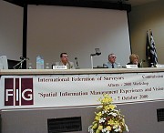
Commission 3 meets in Athens - Experiences
and Visions for the 21st Century
 |
Commission 3 Annual Meeting and Seminar was held in
Glifada, Athens 4-7 October. The seminar was attended by almost 100
delegates from 17 countries. The proceedings from the seminar titled "Spatial
Information Management - Experiences and Visions for the 21st Century"
will be published on the Commission 3 web site later this year. The
next Annual Meeting and International Seminar will be held in Nairobi,
Kenya 2-5 October 2001. This meeting will be hosted by FIG,
UNCHS(Habitat) and ISK, Kenya. |
The title of the seminar was "Spatial Information Management -
Experiences and Visions for the 21st Century". The experiences and
visions that resulted from the seminar can be listed as follows:
Experiences
- National Spatial Information Infrastructure (NSDI) is an Asset for
all Nations in general. It should be considered as a key part of wider
infrastructure assets such as roads, telecommuni-cation networks etc.
- Establishing of a Spatial Information Infrastructure demands
co-operation/partnership be-tween the public and the private sectors and
amongst the variety of professions involved.
- Given the complexity of existing institutional structures, one can
expect conflicts when seek-ing co-operation in NSDI strategy formulation
and implementation.
- NSDI can proceed even if a formal policy document [top down
approach] does not exist. It is possible to proceed with certain
operational level activities [bottom up approach] while the policy is
being formulated. These activities can themselves drive and encourage
policy.
- Every NSDI will be different, depending on cultural needs, social
evolution, economic reality and national ambitions. The environmental
framework and the market demand will shape the most appropriate SDI.
- NSDI policy must be flexible to address rapidly changing needs and
wishes of the users and adapt to changing technologies.
- Varied applications and services through a project oriented approach
will bring reality to the NSDI (GSDI). An over emphasis on data
acquisition, without a market linked application, will not provide any
momentum for further development.
- The potential values and benefits have to be demonstrated through
large scale projects to en-courage further investment.
- Currently, it is often difficult, or even impossible, for users to
sensibly combine data from different sources.
- It is essential that users are involved in defining and testing the
associated products and serv-ices.
- Visualisation, modelling and analysing activities will be the focus
of value added services in the years to come.
Visions
- Cadastral, topographic and thematic datasets should adopt the same
overarching philosophy and data-model to achieve multi-purpose data
integration, both vertically and horizontally.
- To be able to integrate and share data we need to focus on research
to understand and resolve different semantics in data.
- To fulfill the different users demands for spatial information
independent of space and time and to exploit the market potential the
full range of spatial data actual as well as historical, should be made
accessible and available.
- Alternative possibilities for the presentation and interpretations
of spatial information, including integration of knowledge, should be
considered.
- The commercial and contractual frameworks for co-operation and the
associated business models will be key issues in the further development
of NSDI.
- To be able to adapt to the e-market rethinking of pricing, rights
and access to data is necessary.
18 October 2000
|


